
")
")
")
")
")
")
")
")
")
")
")
")
")
")
")
")
")
")
")
")
")
Description
Annapurna Conservation Area Maps: Tilicho - Chulu Pisang Peak | Latest Trekking Map
Product Information
-
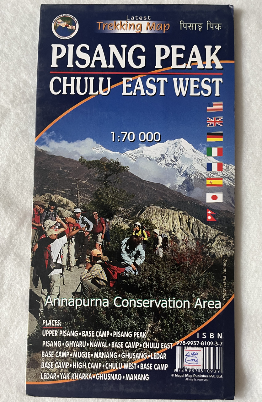
Title: Annapurna Conservation Area Maps – Tilicho, Chulu Pisang Peak
-
Scale: 1:70,000
-
Format: Latest Trekking Map
-
ISBN-13: 9789937810937 / 978-9937810937
-
Coverage Area: Tilicho, Chulu East & West, Pisang Peak
Overview
Embark on an unforgettable trekking experience in the Annapurna Conservation Area with this detailed trekking map of the Tilicho - Chulu Pisang Peak region. This map covers major trekking routes, peaks, and base camps, making it an essential companion for trekkers, climbers, and adventure seekers heading to this stunning part of the Himalayas.
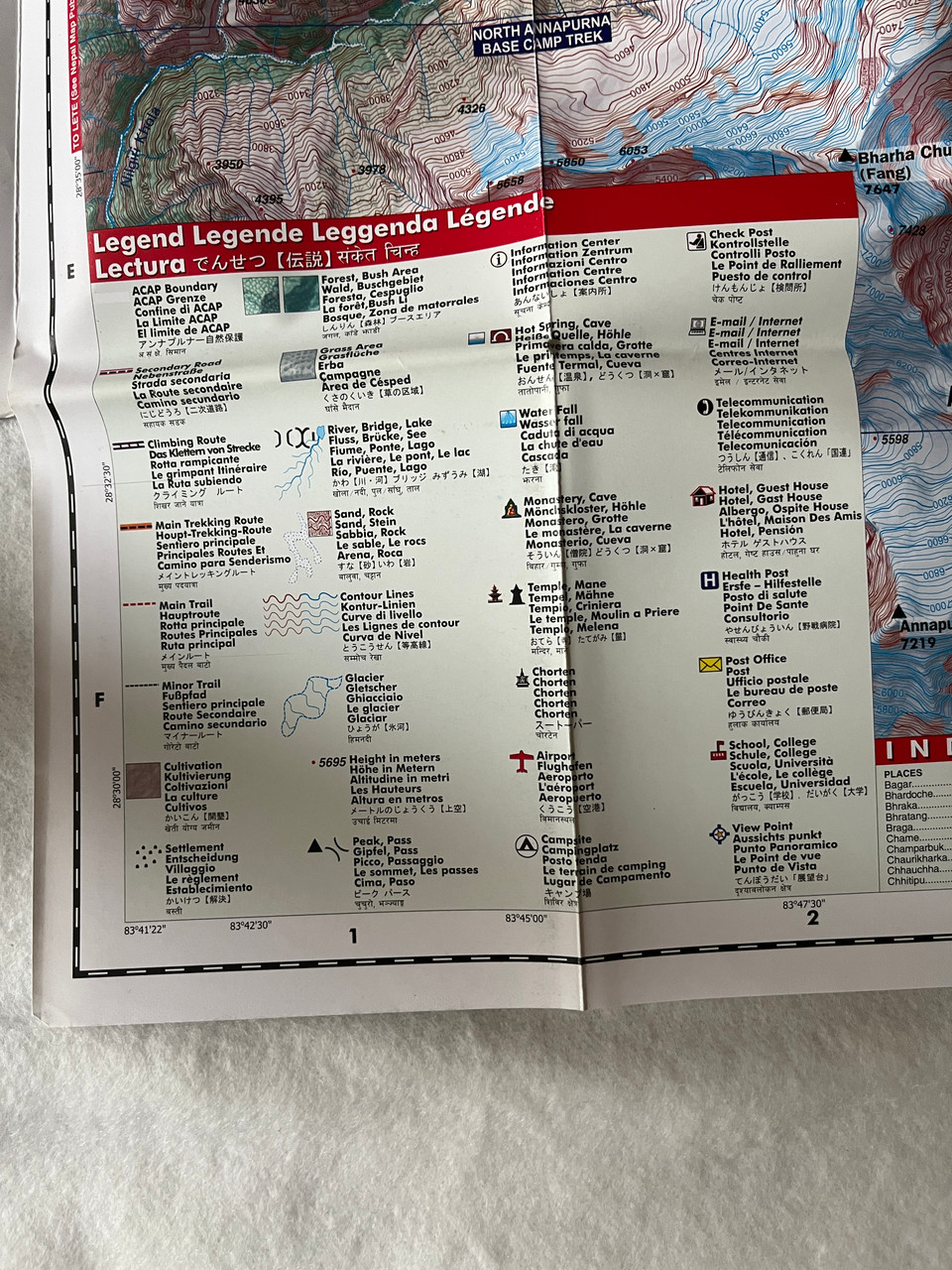
Designed at a scale of 1:70,000, this map provides accurate topographical details, trekking trails, altitude points, and key landmarks, ensuring that you are well-prepared for your journey.
Perfect for trekking enthusiasts exploring the Annapurna region!
Key Features
✔ Comprehensive Coverage – Includes Tilicho, Chulu East & West, and Pisang Peak trekking routes.
✔ High-Quality Cartography – Accurate topographical details, elevation markings, and trekking trails.
✔ Essential for Trekkers & Climbers – Covers base camps, high passes, and notable peaks in the area.
✔ Latest Trekking Map – Up-to-date routes and key locations for a hassle-free trekking experience.
✔ Durable & Lightweight – Easy to carry for trekking, climbing, and adventure travel.
Places Covered
Major Trekking Landmarks & Campsites
-
Manang
-
Khangsar
-
Kharka
-
Tho Kharka
-
Top of Col
-
Tilicho Base Camp
-
Tilicho Lake Southern Base Camp
-
High Camp
-
Eastern Pass Northern Campsite
-
Mesokanto Bhanjyang High Kharka
-
Kaisang
-
Thinigaon
-
Jomsom
This detailed trekking map helps navigate one of Nepal’s most famous high-altitude routes, guiding you through the breathtaking landscapes of the Annapurna region.
Interesting Facts
Tilicho Lake (4,919m) is one of the highest-altitude lakes in the world!
Chulu East & West Peaks are popular among climbers for their challenging yet rewarding ascents.
Pisang Peak (6,091m) is a sought-after trekking peak with stunning panoramic views.
The Mesokanto La Pass is an alternative route to Jomsom, offering spectacular mountain scenery.
Who Should Use This Map?
✅ Trekkers exploring the Tilicho, Chulu, and Pisang Peak regions.
✅ Mountaineers attempting high-altitude climbs in the Annapurna Conservation Area.
✅ Travelers & Adventure Seekers planning an unforgettable journey in Nepal.
✅ Guides & Expedition Leaders requiring an accurate and up-to-date reference map.
Hashtags
#AnnapurnaTrekking #TilichoLake #PisangPeak #ChuluEast #ChuluWest #HimalayanTrekking #NepalTravel #AdventureTrekking #TrekkingMap #HikingNepal #TilichoTrek #AnnapurnaBaseCamp


")
")


")
")
")
")
 5416 m. Latest and Updated Trekking Map अन्नपूर्ण Nepal Map Publisher Pvt. Ltd. (9789937806220)")
 5416 m. Latest and Updated Trekking Map अन्नपूर्ण Nepal Map Publisher Pvt. Ltd. (9789937806220)")